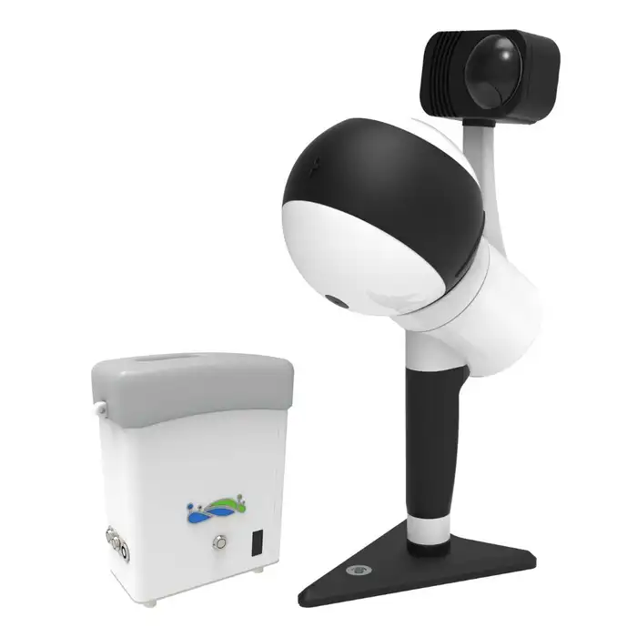
Description
Specification:
Supports SLAM, PPK-SLAM, and RTK-SLAM
Scan rate: 640,000 pts/s
Scan range: Scan Range up to 300 m
Laser accuracy up to ± 1cm
Multi-platform compatibility
1″ CMOS camera that supports 6k images and performs well even in low-light areas
Supports handheld, backpack, vehicle-mounted, and airborne platforms
System Parameters
Size: L195mm×W125mm×H350mm
Battery Pack Size: L134mm×W64.6mm×H167mm
Handheld Weight: 1.67kg (Including Tripod and Camera)
Protection rating: IP54
Port: USB, Ethernet
Voltage: 15.2V
Storage: 512GB
Battery: 5870mAh
Single Battery Life: 3h
Continuous Scanning Duration: up to 55 minutes
Suitable Environments: Versatile for a wide range of indoor and outdoor applications
LiDAR Sensor Parameters
Scan Rate: 640,000 pts/s
Scan Range: Up to 300 meters
Scanning Accuracy: Up to 1cm
FOV: 280°×360°
Camera Parameters
Camera Type: INSTA ONE RS 1-inch Panoramic Camera
Photo Resolution: 6528×3264
Data Format: MP4 INSV
Video Resolution: 6144×3072
Size: L95mm×W60mm×H55mm (including heat dissipation structure)
CMOS Size: 1 inch
RTK Module *
GNSS System: GPS+BDS+Glonass+Galileo+QZSS, Supports 5 constellations and 16 frequencies
RTK Accuracy: 1cm+1ppm
RTK/PPK Protocol: NTRIP
Size: L97mm×W71mm×H30mm
Weight: 190g
RTK Data Format: .rtk
GNSS Raw Data Format: .log
Compatibility: RTK /PPK models support for LiGrip H300, and LiGrip H120
Mapping Method
Mapping Method: RTK-SLAM, PPK-SLAM, SLAM
Real-time Processing: Supported
Data Outcomes
Relative Accuracy: Up to 1cm
Absolutely Accuracy: ≤5cm
Point Cloud Data Format: Las, LiData
Reviews
There are no reviews yet.